Anúncios
Natural disasters strike without warning, but technology now enables us to receive earthquake alerts within seconds of detection, potentially saving lives and property.
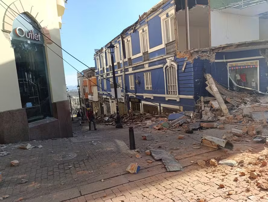
Earthquakes remain one of nature’s most unpredictable forces, capable of causing devastating destruction in mere seconds.
Anúncios
From the 2011 Tōhoku earthquake in Japan to the recent tremors across Turkey and Syria, seismic events continue to remind us of our vulnerability.
The difference between safety and tragedy often comes down to mere seconds of advance warning.
Anúncios
Real-time earthquake alert systems have evolved dramatically over the past decade, transforming from exclusive government infrastructure into accessible smartphone applications.
These systems detect the initial, less-destructive P-waves of an earthquake and send notifications before the damaging S-waves arrive.
While this window might be just 5-30 seconds, it’s enough time to take protective action that can save lives.
🌍 How Real-Time Earthquake Detection Actually Works
Understanding the science behind earthquake alerts helps explain why they work and what their limitations are.
When an earthquake occurs, it releases energy in the form of seismic waves that travel through the Earth’s crust at different speeds.
Primary waves (P-waves) travel at approximately 6-7 kilometers per second and are the first to reach seismometers. These waves typically cause minimal damage but serve as the critical early warning signal.
Secondary waves (S-waves) follow at roughly 3-4 kilometers per second and carry most of the destructive energy.
Modern detection networks place seismometers strategically across fault zones and seismically active regions.
When multiple sensors detect P-wave activity simultaneously, algorithms calculate the earthquake’s epicenter, magnitude, and projected impact zones within 2-5 seconds.
This information immediately transmits to alert systems, which push notifications to devices in affected areas.


The Critical Time Window
The further you are from the epicenter, the more advance warning you receive.
Someone 100 kilometers away might get 20-30 seconds of notice, while someone 10 kilometers away might only get 5-10 seconds.
For earthquakes occurring directly beneath a city, warnings may arrive simultaneously with shaking.
This system proved its worth during the 2019 Ridgecrest earthquake in California, where Los Angeles residents received alerts up to 48 seconds before strong shaking began.
The ShakeAlert system sent warnings to over 1 million devices, demonstrating the technology’s practical application at scale.
📱 Top Earthquake Alert Apps and Systems Available Today
Several robust platforms now deliver earthquake notifications directly to smartphones, each with distinct features and coverage areas. Choosing the right one depends on your location and specific needs.
Global Coverage Solutions
Earthquake Network operates one of the world’s largest crowdsourced seismic detection systems, with millions of smartphones acting as distributed sensors.
The app monitors device accelerometers to detect shaking patterns consistent with earthquakes, supplementing traditional seismometer data. Coverage spans every continent, making it ideal for international travelers.
MyShake, developed by the University of California, Berkeley, combines crowd-sourced detection with official seismological data.
The app provides global coverage and includes educational resources about earthquake preparedness.
Its algorithm can distinguish between actual seismic activity and other vibrations like dropping your phone or riding in a vehicle.
LastQuake by the European-Mediterranean Seismological Centre focuses on rapid information dissemination after earthquakes occur.
While it includes some predictive capabilities, its strength lies in crowdsourced damage reports and safety check-ins, helping emergency services identify affected areas quickly.

Region-Specific Alert Systems
ShakeAlert serves the West Coast of the United States through partnerships with USGS, California Governor’s Office of Emergency Services, and other agencies.
The system integrates with Android’s Earthquake Alerts System and is built into iOS for California, Oregon, and Washington residents. Detection relies on over 1,600 seismometer stations providing millisecond-level precision.
Japan’s J-Alert represents the gold standard for earthquake early warning, refined through decades of seismic activity experience.
The system broadcasts through television, radio, mobile phones, and outdoor speakers simultaneously.
Japanese residents receive color-coded alerts indicating expected shaking intensity, with green (minor), yellow (moderate), orange (strong), and red (severe) warnings.
Mexico’s SASMEX (Sistema de Alerta Sísmica Mexicano) protects Mexico City and surrounding regions, particularly against earthquakes originating along the Pacific coast.
The system has provided up to 90 seconds of warning for the capital, enough time to evacuate buildings and stop critical infrastructure like trains.
⚙️ Setting Up Your Alert System for Maximum Effectiveness
Simply downloading an app isn’t enough—proper configuration ensures you receive timely warnings without unnecessary disruptions. Follow these specific steps to optimize your earthquake alert setup.
Initial Configuration Best Practices
Enable location services with “Always Allow” permission so the app can calculate your distance from detected earthquakes accurately.
Apps using “While Using” permission may miss critical alerts if not actively open during seismic events.
Configure magnitude thresholds based on your local building codes and personal risk tolerance.
Most experts recommend setting alerts for earthquakes of magnitude 4.0 or higher within your immediate area, and magnitude 5.5+ for regional warnings.
Lower thresholds in seismically active areas may result in alert fatigue from frequent minor tremors.
Test notification settings during initial setup. Many apps include a “test alert” feature that simulates real warnings. Verify that sound plays at adequate volume, even with your device in sleep mode or Do Not Disturb activated.
Most earthquake apps override silent mode by default—confirm this feature is enabled.
Managing Multiple Alert Sources
Using 2-3 complementary alert systems provides redundancy without overwhelming you with duplicate notifications.
Consider pairing one crowd-sourced app with one official system. For example, combine Earthquake Network’s rapid detection with your regional official warning system for verification.
Configure notification priorities differently for each app. Set your primary trusted source to “Critical Alerts” (iOS) or “Allow interruptions” (Android), while secondary sources use standard notifications.
This creates a tiered alert system where urgent warnings break through immediately, while supplementary information arrives without alarm sounds.
🏠 What to Actually Do When You Receive an Alert
Having seconds of warning means nothing without a prepared response plan. Your actions during those critical moments can determine your safety during an earthquake.
Immediate Indoor Response Protocol
The moment you receive an alert indoors, immediately Drop, Cover, and Hold On. Drop to your hands and knees before the shaking knocks you down.
Crawl under a sturdy desk or table, covering your head and neck with your arms. If no shelter is available, crawl next to an interior wall away from windows, staying on your knees while covering your head.
Avoid doorways—this outdated advice originated from unreinforced adobe structures.
Modern buildings have equally strong or stronger interior walls, and doorways pose injury risks from swinging doors. Stay away from windows, hanging objects, mirrors, and tall furniture that could topple.
If you’re in bed when the alert arrives, stay there and cover your head with a pillow. Moving in darkness increases injury risk, and beds offer protection from most falling objects.
Exception: if heavy objects or glass hang directly above your bed, roll to the floor and take cover beside the bed.
Outdoor and Vehicle Response
Outdoors, move away from buildings, utility wires, streetlights, and trees. Once in the open, drop to the ground and stay there until shaking stops.
Most outdoor earthquake injuries result from falling building facades, windows, and architectural details.
In a vehicle, pull over to a clear location away from overpasses, bridges, power lines, and buildings if time permits. Set the parking brake and remain inside with your seatbelt fastened.
The car will shake violently, but it provides protection from falling debris. After shaking stops, proceed cautiously, watching for road damage and fallen obstacles.
🔧 Advanced Features Worth Exploring
Modern earthquake alert platforms include sophisticated features beyond basic notifications. Understanding these capabilities helps you leverage the technology fully.
Customizable Alert Zones
Many apps allow you to set multiple monitoring locations beyond your current position. Add zones for family members’ homes, workplaces, schools, or frequently visited locations.
When earthquakes strike these areas, you’ll receive notifications even if you’re elsewhere, enabling you to check on loved ones immediately.
Geographic radius settings determine how far from each monitored location you want to receive alerts.
A 50-kilometer radius works well for immediate personal safety, while a 200-kilometer radius provides regional awareness for areas where family resides.
Historical Data and Pattern Analysis
Access to historical earthquake data reveals patterns in your area. Most apps display maps showing all recorded seismic activity over selectable timeframes—24 hours, 7 days, 30 days, or longer.
This information helps contextualize risk and identify whether recent activity represents normal background seismicity or potentially elevated danger.
Interactive maps typically use color coding to indicate magnitude and symbol size to represent depth.
Shallow earthquakes (less than 70 kilometers deep) pose greater surface danger than deep earthquakes of equal magnitude.
Clusters of small earthquakes sometimes precede larger events, though reliable earthquake prediction remains scientifically impossible.
Community Reporting and Social Features
Crowdsourced “Did You Feel It?” reports create real-time maps showing actual experienced shaking intensity.
These reports often provide more practical information than seismometer readings, as local soil conditions, building types, and floor level dramatically affect perceived intensity.
Contributing your own experience helps emergency services assess damage patterns and allocate resources. Report shaking intensity, observed damage, and current safety within seconds through simple interfaces.
This data becomes especially valuable in developing regions with limited seismometer coverage.
⚠️ Understanding Limitations and False Positives
No alert system achieves perfect accuracy. Understanding common limitations helps set realistic expectations and prevents complacency or alarm fatigue.
When Alerts Fail to Arrive
Earthquakes occurring directly beneath your location may provide zero advance warning, as P-waves and S-waves arrive nearly simultaneously.
Systems cannot warn you about “the big one” if you’re at the epicenter—they protect people farther away who will experience delayed shaking.
Network connectivity issues can delay or prevent alerts from reaching your device. Earthquakes often damage cell towers and internet infrastructure, creating communication dead zones.
This vulnerability highlights why alerts work best for earthquakes centered away from your location, where infrastructure remains intact.
Magnitude calculations sometimes require revision.
Initial automated assessments may underestimate or overestimate earthquake size by 0.5-1.0 magnitude units, with updates arriving 10-30 seconds later as more data processes.
A preliminary magnitude 5.5 alert might revise to 6.2, or vice versa.
Handling False Alarms
Crowd-sourced systems occasionally trigger false positives from coordinated non-seismic events like nearby construction, thunder, or vehicle collisions.
Official systems using dedicated seismometers rarely false alarm, but crowd-sourced apps accepting smartphone accelerometer data might alert once or twice per year incorrectly.
Don’t disable alerts after a false positive.
The inconvenience of one incorrect warning pales compared to missing a real earthquake.
Instead, adjust magnitude thresholds slightly higher if false alarms become frequent, finding a balance between sensitivity and practicality.
🌐 Regional Considerations Around the World
Earthquake alert effectiveness varies dramatically by region based on seismometer density, government investment, and local seismic characteristics.
North America
The United States West Coast benefits from extensive ShakeAlert coverage, with the system reaching over 50 million residents.
Alaska, despite high seismic activity, has limited coverage due to vast distances and sparse population.
Hawaii maintains moderate alert capabilities, while the Eastern United States, despite occasional significant earthquakes, lacks comprehensive early warning infrastructure.
Canada’s earthquake early warning system launched in 2024 for British Columbia, providing coverage for Victoria, Vancouver, and surrounding areas vulnerable to Cascadia Subduction Zone earthquakes.
The system ties into ShakeAlert infrastructure, sharing data with U.S. systems for improved cross-border detection.
Mexico’s SASMEX primarily protects against coastal earthquakes threatening inland cities.
The system proved its value during the September 2017 earthquakes, though the devastating Puebla earthquake originated too close to Mexico City for adequate warning, demonstrating inherent system limitations.
Asia-Pacific
Japan’s comprehensive system integrates into virtually all electronic devices sold domestically, from televisions to rice cookers.
The infrastructure costs exceed $1 billion but prevents estimated casualties and economic losses worth tens of billions.
Alerts include specific instructions, such as stopping trains (which automatically brake) and opening elevator doors at the nearest floor.
Taiwan’s earthquake early warning system ranks among the world’s most advanced, providing alerts through television, radio, SMS, and dedicated apps.
The dense seismometer network delivers typical warning times of 10-20 seconds for the capital Taipei.
Indonesia, the Philippines, New Zealand, and other Pacific Ring of Fire nations have developed varying levels of alert infrastructure.
New Zealand’s GeoNet provides excellent coverage for a geographically dispersed population, while Indonesia continues expanding its system across thousands of islands.
Europe and Mediterranean
The European-Mediterranean region faces moderate earthquake risk, with particularly vulnerable zones in Italy, Greece, and Turkey.
Alert systems remain less developed than Pacific Ring counterparts, though recent devastating earthquakes have accelerated investment.
Turkey committed to nationwide early warning expansion following the February 2023 earthquakes.
Romania and Iceland maintain localized alert systems addressing specific geological threats—Vrancea zone deep earthquakes and volcanic activity, respectively.
Switzerland’s dense seismometer network primarily serves research rather than public alerts, given the country’s relatively low earthquake risk.
🔮 The Future of Earthquake Alert Technology
Emerging technologies promise to expand warning times, improve accuracy, and potentially predict earthquakes days or weeks in advance.
Machine Learning and AI Integration
Artificial intelligence algorithms now analyze vast datasets including historical seismic activity, GPS ground deformation measurements, groundwater changes, and electromagnetic anomalies.
Google’s AI-powered earthquake detection system in Android devices creates the world’s largest seismometer network, with hundreds of millions of phones acting as sensors.
Deep learning models process seismic data 50-100 times faster than traditional methods, potentially adding precious seconds to warning times.
These systems also better distinguish between earthquakes and other sources of vibration, reducing false positives.
Satellite and Space-Based Detection
NASA and other space agencies research satellite detection of pre-earthquake atmospheric and ionospheric changes.
Some studies suggest electromagnetic disturbances occur hours or days before major earthquakes, though conclusive evidence remains elusive.
If validated, satellite systems could provide strategic warning of elevated risk, enabling proactive emergency preparations.
GPS satellite networks already track millimeter-scale ground deformation along fault zones, identifying stress accumulation.
While this data doesn’t enable specific earthquake prediction, it improves long-term hazard assessments and might eventually contribute to probabilistic forecasting.
Integration with Smart Home and Building Systems
Future alert systems will automatically trigger protective responses in connected buildings.
Imagine earthquake warnings that instantly shut off gas lines, open garage doors, stop elevators at the nearest floor, and activate emergency lighting—all before shaking begins.
Smart infrastructure could revolutionize industrial safety, automatically shutting down chemical plants, nuclear reactors, and manufacturing equipment when alerts arrive.
Japan already implements train auto-braking, which has prevented derailments and saved countless lives during dozens of significant earthquakes.
📋 Essential Preparations Beyond Alert Apps
Alert systems provide critical warning time, but comprehensive earthquake preparedness requires advance planning and physical preparations.
Creating Your Earthquake Kit
Assemble supplies sufficient for 72 hours of self-sufficiency: one gallon of water per person per day, non-perishable food, flashlight, battery-powered radio, first aid kit, medications, copies of important documents, cash, and phone chargers including portable batteries.
Store heavy items on lower shelves and secure tall furniture to walls with brackets.
Place beds away from windows and heavy objects that could fall during shaking. Identify safe spots in every room where you spend significant time, visualizing your drop-cover-hold response.
Family Communication Planning
Designate an out-of-area contact person whom all family members can call or text after an earthquake. Local phone circuits often overload, but long-distance calls may still connect.
Establish meeting locations if separation occurs—one near your home and another outside your neighborhood.
Practice earthquake drills quarterly, particularly with children. Muscle memory developed through repetition enables automatic protective responses when alerts arrive during stressful real emergencies.
Time your drills to match realistic warning periods—15 seconds to take cover from alert to shaking.
💡 Making Alert Systems Part of Your Safety Culture
Technology provides tools, but human behavior determines outcomes. Integrating earthquake alerts into daily awareness creates resilience that technology alone cannot achieve.
Review alert settings quarterly, updating monitored locations as life circumstances change. Test notifications to ensure device updates haven’t disabled critical features.
Discuss recent earthquakes with family members, using news events as opportunities to reinforce preparedness without creating anxiety.
Share alert system information with neighbors, coworkers, and community groups.
Collective preparedness amplifies individual safety—when entire neighborhoods respond appropriately to warnings, everyone benefits from reduced chaos and faster recovery.
Real-time earthquake alerts represent one of the most practical applications of mobile technology for public safety.
These systems cost nothing to individual users, require minimal effort to implement, and provide potentially life-saving warnings.
The seconds of advance notice they deliver create opportunities to take protective actions that reduce injuries and save lives during one of nature’s most violent phenomena.
Download an alert app today, configure it properly, and integrate it into your broader earthquake preparedness strategy. Those few seconds of warning could make all the difference when the ground begins to shake.